As with all small towns there are cemeteries and burial places where the earliest settlers were laid to rest before towns and churches owned and organized common burial grounds. Then there are also private burial grounds that have been lost and forgotten over time. I am aware of some of each which I will share here (and will be added to as new information is discovered). Also included below are those graveyards the Town of Readfield owns and maintains.
"Lost and Forgotten" Cemeteries
NORTON
Stephen and Sarah (Fosdick) Norton settled above Readfield Corner on the intersection of Church Road and Chase Road. Their farmhouse was located on the southwest corner of that intersection. Later members of the Norton family resided in a farmhouse across the road (within our memories it was the Eliot house and then Tim and Sandra Rourke lived there). Stephen and Sarah (Fosdick) Norton are buried on the site of where their (original) Norton homestead was located. It is not know at this time if other members of the Norton family are also buried there but it seems feasible they would have been.
WING
According to "The Owl" Vol.3-5: 1) "Samuel Wing of Maine" page 169 and 2) "Elnathan Wing, A Maine Pioneer" page 113: Samuel Wing was buried on the east side of the pond in Readfield, Maine. At the time those issues were published / the articles were written, circa 1900, "thirty or more people (are) buried there but the site was covered by a dense growth at the time and all signs of the graves were obliterated." Samuel Wing was one whose resting place is in that cemetery. He came to Readfield circa 1771 and settled on North Road, near what we now call Tingley Brook, which feeds Lake Maranacook. He died in 1785 when he fell of the roof of his house. His son Daniel carried on his homestead.
The location of this cemetery is not known at this time, other than the vague description "on the east side of the pond" as stated above. One would suspect this was Lake Maranacook. Some early settlers established homesteads on South Road, which runs parallel to the east side of Maranacook. Could it have been there? Does not seem likely it was the same cemetery as the one at the head of Maranacook (see below) as that part of town was cleared of dense growth by the time this article was written circa 1900; nor Whittier Cemetery (below) as that was also clear of dense growth at that time. Perhaps that is where Henry Wyman is buried - we have had NO luck identifying his burial place and he was a significant man in Readfield's early history.
"The Owl" is the Wing family organization, an acronym for "Our Wing Lineage". They have produced a magazine which they also call "The Owl" since 1899. At one time "The Owl" was available for viewing online but is no longer. Prior copies are available in their gift shop.
THE OLD "HEAD OF MARANACOOK" CEMETERY
History tells us that east of Readfield Corner in the area of Hunt's Lane there is an ancient burial ground where some of our early settlers were buried before 1800. This burial ground fell into obscurity and became plowed land sometime in the early 19th Century. Around 1900 there were still people living in Readfield who remembered this cemetery had once existed. They told how within their memories there were only mounds there and no gravestones. It is not known who was buried there nor if this cemetery had a name but I have some thoughts on possibilities for its origin.

Freewill Baptist Meetinghouse which is currently a private residence.
The "Head of Maranacook Burial Ground" was located across the road from the Freewill Baptist Meetinghouse which was built in 1844 (later Readfield Town Hall and now a private residence). So, could it have been an old Baptist cemetery?

The homestead of Joshua Bean is located a short distance from this old burial ground.
The more logical is this theory when you consider the timing. This land was originally owned by Joshua Bean - an early settler and prosperous landowner. Among his holdings was lot #214 at the north end of Lake Maranacook. Joshua Bean was a devout Quaker with a very large family of 13 children. According to the Bean Family Genealogy, by Bernie (Bean) MacBean, there was a serious break in the Bean family between 1800-1809 and three of Joshua's sons and a grandson gathered all their worldly possessions and moved their families to Jay where they started their own "Bean Quaker Colony." That in itself might not give rise to this theory except for one additional piece to this story. When they moved from Readfield they left almost no trace of their residence in town. They even dug up the caskets of some of their dead, brought them to Jay by oxcart and reburied them at Bean's Corner in Jay. Could this have been the Bean Cemetery and those mounds that were remembered by some were all that was left behind? This is just speculation tis true but it seems to fit well with what little information we have about this graveyard.
ARMSTRONG CEMETERIES
THERE ARE TWO - one is in Winthrop and the other is in Readfield. Both are on side roads off route 41 (Winthrop Road.) They are near each other, and on private property. Readfield Armstrong Cemetery Located on former Martha Washington Inn property, which was originally owned by William Armstrong. For more information contact the Readfield or Winthrop town offices. To see a complete listing of people buried in these cemeteries follow this link.
Information is available online at the official Town of Readfield website, including a downloadable map of cemetery locations. Follow this link.
Dudley Plains Cemetery est. 1789 |
| According to town records Dudley Plains Cemetery was established in 1789 though Deborah Dudley, wife of Joseph, was buried here as early as 1780. |
When you look at an 1856 or 1879 map of Readfield you will see the name Dudley all along the Plains Road and on several adjacent roads. Though the Dudley name is not evident in current town rolls, you can still find them in the old family burial ground est. 1789. Many of the other earliest Readfield settlers who helped settle Dudley Plains are buried in this cemetery also. There are many descendants in this area who do not bear the Dudley surname, but who share in their legacy.
WHITTIER CEMETERY est.1850

This was private cemetery until it was deeded to the Town of Readfield in 1974 by Eugene and Grace Whittier. Eugene and Grace Whittier are not buried here themselves but are in
the East Readfield Cemetery. There are Whittier ancestors buried in this
graveyard however - the first generation being Josiah Whittier and his wife Sally White Whittier. Her parent's graves are marked with fieldstones - Samuel White
and his wife. It is said that Sally Whittier's sister Clara, a
dwarf, is buried in the grave with her. A log cabin was first built on this place where the Whittier Cemetery now stands, thought to be that of Ransford Smith. From route 17 at Readfield Depot take South Road which turns into Beaver Dam Road. Soon after your turn a sharp corner look to your right and it sits in the field on a knoll. Essentially, it is located between the Beaver Dam Road and Tallwood Drive. Access it by parking beside the road and walking across the field. Watch out for the poison ivy! For a complete listing of those buried in this cemetery follow this link.
EAST READFIELD CEMETERY est. 1788

East Readfield Cemetery is in proximity to Jesse Lee Methodist Meeting House, which
is the oldest Methodist church still in use in New England.

Located on the corner of Route 17 and Plains Road across the intersection from Jesse Lee Church. This cemetery was deeded to the town by Nathaniel Whittier in 1788 - early in our town's history. Many of our town's founders and generations that followed are buried here, including Nathaniel Whittier. This is the second largest cemetery in Readfield.
CASE CEMETERY est.1789

The North Manchester Meeting House was built in 1793 on same location as the Case Cemetery. It was moved to Scribner Hill Road, North Manchester in 1839 by vote of the congregation who wanted their church closer to home. The church was built by Baptists under the leadership of Elder Isaac Case, famed Colonial Baptist preacher and missionary. Today (2013) it is non-denominational. Rev. Isaac Case, his wife, son Elisha and two daughters are buried in Case Cemetery.
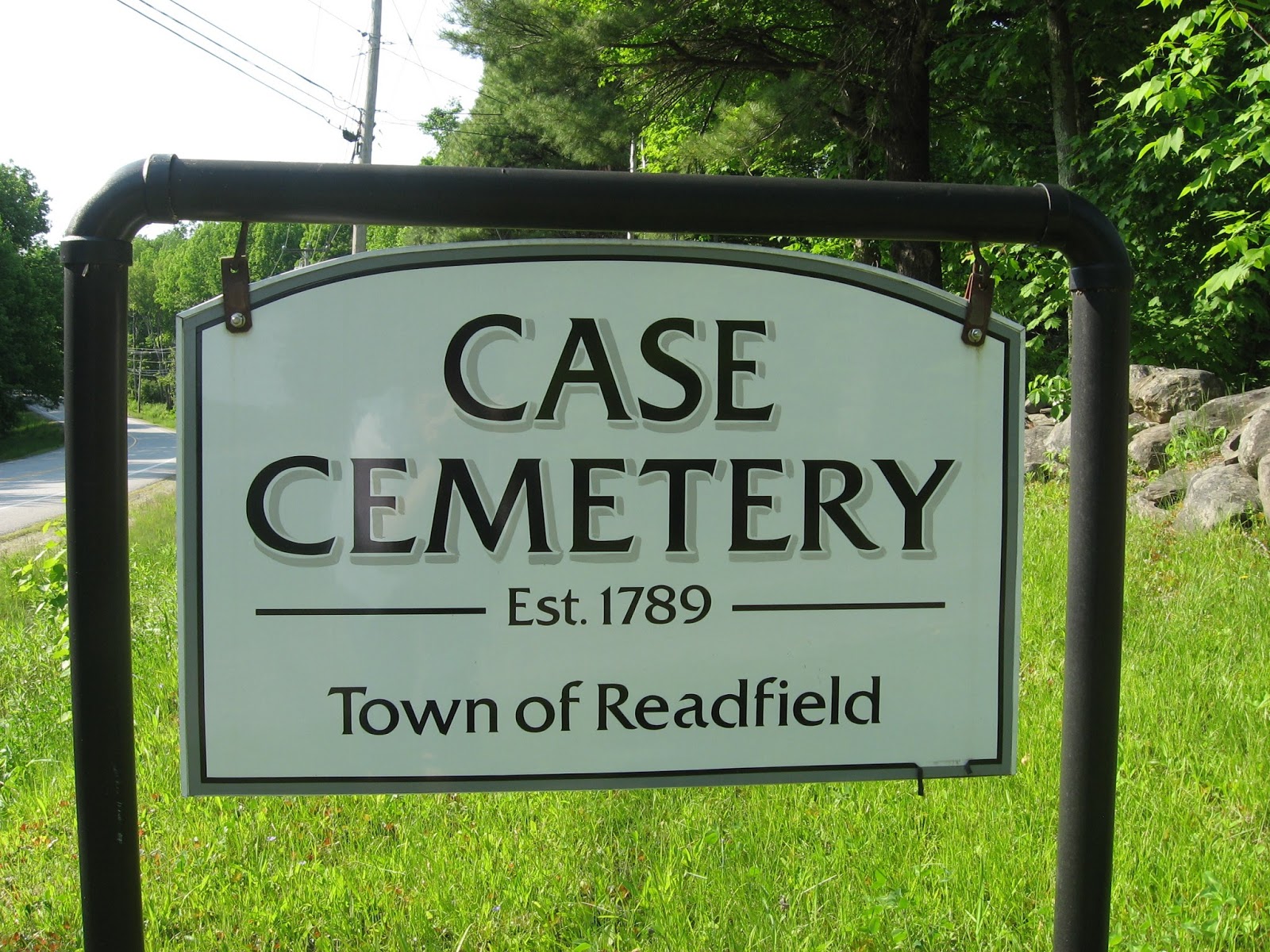
Located on Route 17 soon after crossing the Manchester / Readfield town line. The land was donated by Mr. Barber for this cemetery and is referred to by some as "Barber Cemetery". The name Case comes from Elder Isaac Case whose Baptist Meeting House was built on this site in 1793 - later moved to North Manchester. An interesting memorial to Case and his wife is in this cemetery - said to be located on the very spot where his pulpit once stood. This is a very old cemetery and many of the graves are marked with fieldstones. For a full listing of those buried in this cemetery follow this link.
HUNTOON CEMETERY est.1835

Peter Huntoon deeded this cemetery to the inhabitants
of Readfield in 1835 for a burial place. He died one year later but today there
is no evidence of a grave marker for him in this cemetery – though one must
assume that is where he is buried. In the 1960’s, according to residents who
lived in the area then and roamed this land, the entire Huntoon Cemetery was
covered with gravestones. Today (10/2012) only about half the graveyard has
visible stones – most of them are a cluster of fieldstones and presumably some,
if not all, of those fieldstones are pauper graves. Located near the old Readfield Town Farm and Forest, off North Wayne Road, in Mcdonald Woods (owned by Kennebec Land Trust). Access to this burial ground requires about a 1/2 mile walk. For a listing of people buried in this cemetery follow this link.
READFIELD CORNER CEMETERY est.1808

This is the largest cemetery in Readfield dating back to early our earliest days. An annex accommodates more recent burials. The oldest graves in this cemetery sit nearly in the center. There are many unmarked graves in that section. Here we find many of the men and women who were influential in forming our town. Maine Governor Jonathan Huntoon is also buried here. Route 17 to Readfield Corner, turn onto Church Road at the four corners / blinking traffic light. Cemetery is about 3/4 mile on the right.
KENTS HILL CEMETERY est.1808

Torsey Memorial Methodist Church is located across the road (route 17) from Kents Hill Cemetery. It was built in 1835. Prior to that Methodists from this part of town attended services at the Kents Hill Meeting House which was dedicated by Rev. Jesse Lee in1800. That was located on the east corner of P Ridge Road and Main Street. Torsey Church was named in honor of longtime KHS headmaster Dr. Henry Torsey as was nearby Torsey Pond.

Names of those who came and settled Kents Hill very early on will be found among the gravestones in this cemetery - such as Packard, Waugh, Kent, Ford, Lane and Haines. Also buried here are Luther Sampson and Elihu Robinson who founded the Maine Wesleyan Cemetery (Kents Hill School), and the much beloved Dr. Henry Torsey. This cemetery is located on route 17 across from Torsey Church (pictured above).
No comments:
Post a Comment